Thursday, October 4, 2012
Day 35-37 Headed Home
On Tuesday morning we joined our group for a Farewell Breakfast. After 33 days together we were all a little reluctant to say "good bye". There were some watery eyes, actual tears and many hugs. There were about eight couples who were headed to the Albuquerque Balloon Festival. Curt, Dawn, Chig & I left for California. Tuesday evening was spent in Needles. There are not many great choices for RV parks but we found one on the Colorado River. We arrived to temperatures over 105 and spent some time in the pool.
Yesterday we continued over the Tehachapi Mountains to Bakersfield. So here we are this morning ready to head north to our home. This has been a fantastic trip but I am ready to go home!
I have enjoyed sharing our trip with you.
Stay tuned for our next adventure : )
Monday, October 1, 2012
Day 33-34 Grand Canyon South Rim
The weather has continued to be beautiful. The high both yesterday and today was 80 degrees. We have seen a lot of mule deer and one male elk with a very large rack. This is rutting season and the males are busy gathering their harems. We have been warned not to get too close as they are somewhat tempermental and may charge. This male had smaller horns but did not mind having his picture taken.
 Of the Seven Natural Wonders, the Grand Canyon is the most visited. It was formed through a combination of uplift from the crust of the earth and millions of years of erosion. It is part of the Colorado Plateau. The average width is 10 miles but at the widest point it is 18 miles wide. At its deepest point it is 5000 ft deep. The Colorado River and its tributaries have caused most of the erosion. The Colorado River is 1450 miles long and 300-400 feet across at the widest points. Annually it carries 100,000 tons of rock debris from the canyon. The south rim has the Rim Trail running the length of the rim. In most areas it is paved and an easy hike.
Yesterday morning everyone met for a four hour bus tour of the east end of the south rim of the canyon.
We made some stops along the way.
Of the Seven Natural Wonders, the Grand Canyon is the most visited. It was formed through a combination of uplift from the crust of the earth and millions of years of erosion. It is part of the Colorado Plateau. The average width is 10 miles but at the widest point it is 18 miles wide. At its deepest point it is 5000 ft deep. The Colorado River and its tributaries have caused most of the erosion. The Colorado River is 1450 miles long and 300-400 feet across at the widest points. Annually it carries 100,000 tons of rock debris from the canyon. The south rim has the Rim Trail running the length of the rim. In most areas it is paved and an easy hike.
Yesterday morning everyone met for a four hour bus tour of the east end of the south rim of the canyon.
We made some stops along the way.

 The main focus of the tour was Desert View which is the rim location of the Watch Tower designed by American architect Mary Colter. The tower was completed in 1932 right on the edge of the rim.
 The interior has many drawings depicting various petroglyphs found in the area.
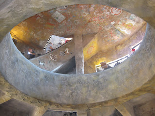 View from the top of the tower
 We came across some wildlife.
Small ~
We came across some wildlife.
Small ~
 And large ~
 The canyon has a great shuttle system. In the afternoon we went to the Sante Fe Train Depot and the El Tovar hotel. The hotel was built in 1905 by the railroad to attract high end travelers. It is frequented by many famous celebrities including Paul McCartney.

 The El Tovar from across a canyon branch.
 We walked for a while along the rim trail then stopped at the Bright Angel Lodge for something to drink. I found an amusing sign in the rest room. In case you cannot read it, it says "Caution - Reclaimed Waste Water - Do Not Drink" Fortunately I don't think anyone would be tempted.
 Here is a picture of Chig & me followed by some additional canyon pictures -


 Tonight was our group farewell dinner. Tomorrow we will have a farewell breakfast.
We have really enjoyed this trip and have met so many wonderful RVers from all over the country. The group age varies from 55 to 80. Couples are from the east coast, the south, the midwest and of course California. This has been a fantastic opportunity to see the southwest.
There will be one more post for this trip.
Tonight was our group farewell dinner. Tomorrow we will have a farewell breakfast.
We have really enjoyed this trip and have met so many wonderful RVers from all over the country. The group age varies from 55 to 80. Couples are from the east coast, the south, the midwest and of course California. This has been a fantastic opportunity to see the southwest.
There will be one more post for this trip.


Saturday, September 29, 2012
Day 30-32 Jacob Lake, Arizona
Thursday we left Lake Powell for Jacob Lake, Arizona, at the northern rim of the Grand Canyon. Here is a picture looking down on our RV park and part of the lake.
 We made a stop at Pipe Spring National Monument located on the Arizona strip between the Grand Canyon and the Vermilion Cliffs. Pipe Springs has been a water source for centuries in the middle of the high desert. The water fron Utah,200 miles north, percolates down to the shale layers and travels southward to the base of the cliffs and surfaces at places like Pipe Spring. The area was first occupied by the Ancestral Puebloans followed by the Paiutes. Next the Catholic Missionaries and explorers came through the area. Later Brigham Young decided it would be a good location for a tithing ranch during the construction of the mormon temple in St. George, Utah.
 He placed Anson and Emmeline Windsor on the ranch to accept tithes of cattle from area church members. Cattle were also raised to help feed the laborers for the temple. A stone home, known as Windsor Castle, was constructed. In later years the National Parks purchased the ranch and designated it as a National Monument.

 We checked into our RV park at Jacob Lake and ate at the lodge.
Yesterday we drove 50 miles to the North Rim of the Grand Canyon. I think I need to check out the Thesaurus. I am running out of words to describe sheer amazing and beautiful nature.
Pictures do not do the canyon justice. It has to be seen in person.
We checked into our RV park at Jacob Lake and ate at the lodge.
Yesterday we drove 50 miles to the North Rim of the Grand Canyon. I think I need to check out the Thesaurus. I am running out of words to describe sheer amazing and beautiful nature.
Pictures do not do the canyon justice. It has to be seen in person.


 We drove to Point Imperial which is the highest point on the north rim at 8803 feet.
We went back to camp for a group campfire and roasted hot dogs followed by s'mores.
This morning we headed to the busier south rim, a 5 hour drive. We passed the Vermilion Cliffs and an area of balanced rocks.
We drove to Point Imperial which is the highest point on the north rim at 8803 feet.
We went back to camp for a group campfire and roasted hot dogs followed by s'mores.
This morning we headed to the busier south rim, a 5 hour drive. We passed the Vermilion Cliffs and an area of balanced rocks.

 We continued to the south rim National Park entrance and settled in to our campground. As we entered the park we saw many pull outs with views but could not safely pull our RV into the area. Tomorrow we will be taking a bus tour.
Just in front of our RV we had a close-up view of an elk.
We continued to the south rim National Park entrance and settled in to our campground. As we entered the park we saw many pull outs with views but could not safely pull our RV into the area. Tomorrow we will be taking a bus tour.
Just in front of our RV we had a close-up view of an elk.


Wednesday, September 26, 2012
Day 27-29 ~ Page, Arizona
On Monday we left Monument Valley, Utah, and headed to Page, Arizona, on Lake Powell. On the way we stopped at the Navajo National Monument. After stopping at the overlook, we watched an interesting film at the visitor's center. We then took a 1 mile trail to an alcove and dwelling site of some Anasazi. We continued to our RV park at Glen Canyon National Park where we have a nice view of Lake Powell.
 Tuesday we met at 6:45 a.m. for a five hour boat trip to Rainbow Bridge on Lake Powell.
The night before we had quite a rain storm and very high winds. During the boat trip we could see rain clouds and lightening around us but by the return trip we had beautiful sunny skies.
Tuesday we met at 6:45 a.m. for a five hour boat trip to Rainbow Bridge on Lake Powell.
The night before we had quite a rain storm and very high winds. During the boat trip we could see rain clouds and lightening around us but by the return trip we had beautiful sunny skies.
 The scenery on the trip was beautiful. The white on the canyon walls is from calcium deposits at the high water mark (the lake is 75 feet below full). The last time the lake was at capacity was 1983-1984.
 After we docked the boat in a narrow canyon, we took an easy walk to Rainbow Bridge.
This is a natural bridge, different from an arch since it has water running under it.
After we docked the boat in a narrow canyon, we took an easy walk to Rainbow Bridge.
This is a natural bridge, different from an arch since it has water running under it.


 Today we went to the Lake Powell Lodge for breakfast then headed to Glen Canyon Dam for a tour. The dam is 25 feet thick at the top and 300 feet at the base.

 This afternoon we took another open truck trip to Antelope Slot Canyon. It is impossible to imagine the millions of years of water wear that caused this amazing geologic feature. These picture are taking looking up from the floor of the slot canyon.

 Here is the outline of a bear.
 Do you see the heart?
 After a long day we had a beautiful sunset.


Sunday, September 23, 2012
Day 25-26 ~ Monument Valley, Utah
Yesterday our group took a 5 1/2 hour tour of Monument Valley. The entire trip was in open air shuttle vehicles along dusty red dirt roads. We really did have a great time.
 Our guide explained that the reservation is making a concentrated effort to teach the native language and skills in the schools. The children learn how to weave, dye material, make jewelry and pottery.
One of the formations is called "The Flintstones" - Fred & Barney.
Our guide explained that the reservation is making a concentrated effort to teach the native language and skills in the schools. The children learn how to weave, dye material, make jewelry and pottery.
One of the formations is called "The Flintstones" - Fred & Barney.
 We drove to some arches. Chig climbed up and took a picture of our group below.

 We then saw an alcove dwelling called Square House.
 Another alcove was called Baby House because there are children's hand and foot petroglyphs on the floor.
 After viewing a large wall of petroglyphs we had Navajo Burgers cooked by our Navajo guides.
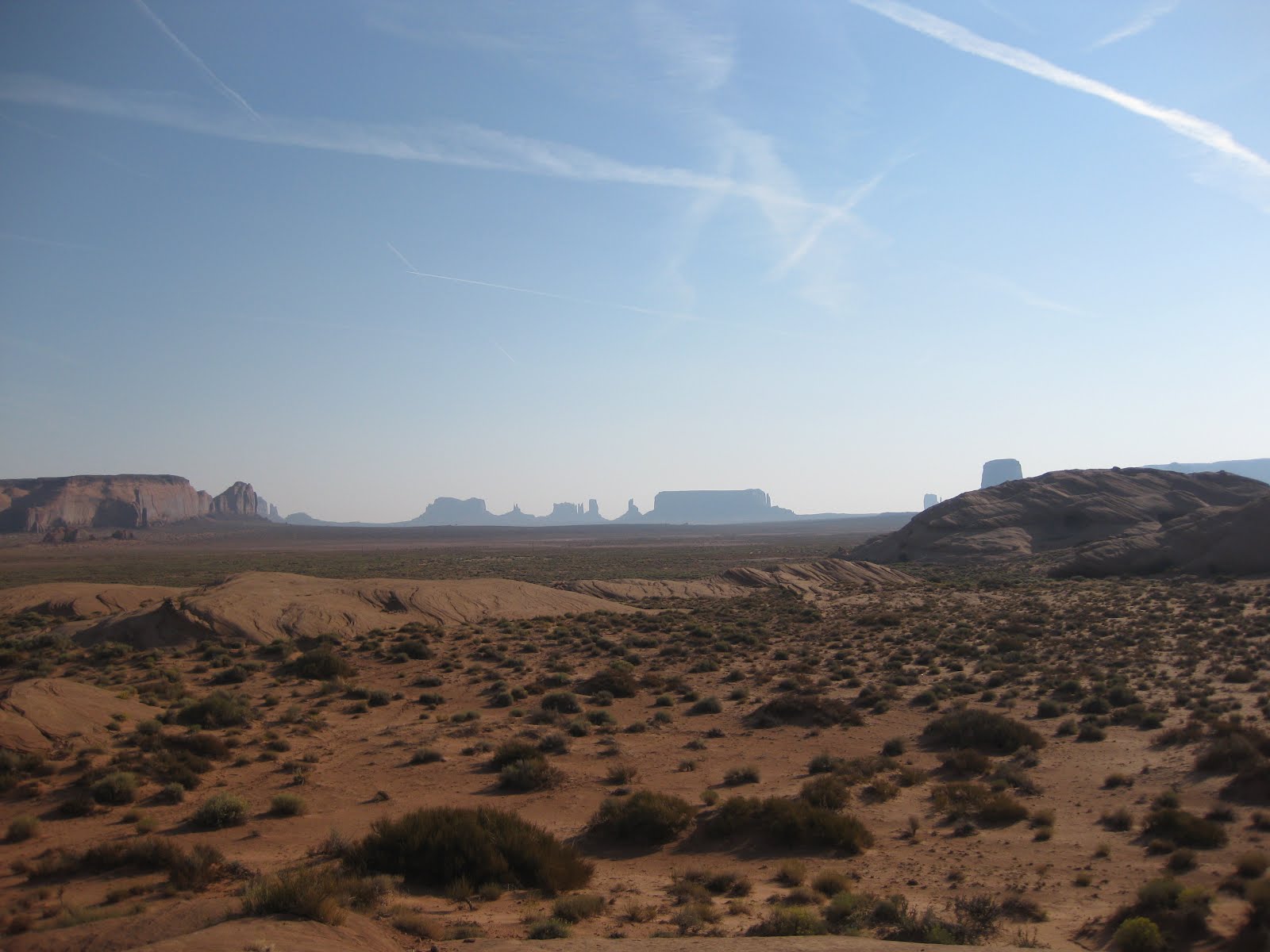
 Today we drove to the visitor's center for Monument Valley Navajo Tribal Park. The center had a small museum and large gift shop. We then started out on the 17 mile loop road through the park. At the first turnout we turned around. The road was rutted dirt with a lot of bumps and dust. The speed limit was 15 mph but we were only able to go 5 mph. Because we had other places to visit we continued on to our next destination, Goosenecks State Park. The pictures do not do it justice. The San Juan river flows in loops at this point and has carved three Gooseneck shaped land masses. It was really quite a sight.

 We continued to a dirt road and another 17 mile dirt/gravel road through Valley of the Gods. The road condition was much better. We saw some interesting rock formations along the way.
This is Lady in a Bathtub.
We continued to a dirt road and another 17 mile dirt/gravel road through Valley of the Gods. The road condition was much better. We saw some interesting rock formations along the way.
This is Lady in a Bathtub.
 We thought this looked like a train engine.
 This afternoon our tour directors treated us to a fantastic quesadilla, nacho, margarita social.


Subscribe to:
Comments (Atom)